coronacation

AmAZing Arizona: Flagstaff, Sedona & More

Recently, I took two weeks to go on a road trip through the state of Arizona.

Traveling, or not traveling, right now is a very personal decision and one that I did not take lightly. My friend and I agreed on some important things ahead of time - we would not be doing any indoor dining, museums, bars, etc.

Some nights, eating outside in November was more comfortable than others (plot twist: Arizona isn’t always warm). Some nights we cooked in our Airbnbs. If we encountered people without masks, even outdoors, we distanced ourselves from the situation.

I will mention things throughout these Arizona city guides in regards to how certain areas, restaurants, etc. handled coronavirus protocols.

But our overall goal for the trip was to hike, run, and generally spend time outside - alone. This was not the trip for trying all of Arizona’s restaurants and bars and museums and this guide reflects that.

You can read about our first stop, Phoenix & The Superstition Mountains here!

You can read about our second stop, Tucson & Saguaro National Park here!

You can read about our third stop, Williams & The Grand Canyon here!

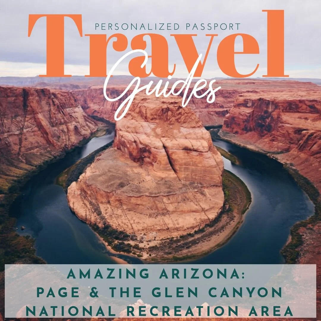
You can read about our fourth stop, Page & The Glen Canyon National Recreation Area here!

Our next stop was Flagstaff, Arizona!
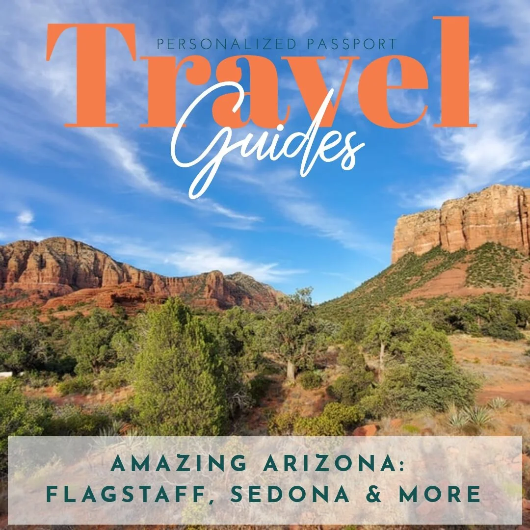
Flagstaff Travel Guide

FLAGSTAFF

WHERE WE STAYED

Another city, another Airbnb! Our Flagstaff Airbnb was an apartment located beneath a family’s house - they have two Airbnb units each with their own outdoor area on the deck. We had two bedrooms, one bathroom, access to laundry, and a cute little kitchen and living room area.

We were in Flagstaff for a little longer than our other spots, so I really settled into my King-sized bed!

Flagstaff is a great spot to base yourself on an Arizona trip - it’s about 90 minutes to the Grand Canyon’s South Rim entrance and under an hour to Sedona’s Red Rocks. In 2 and a half hours you can even reach Antelope Canyon, Horseshoe Bend and Phoenix.

Flagstaff itself is a city surrounded by everything from mountains, to deserts to ponderosa pine forests. In the winter, it’s a ski destination (the Arizona Snowbowl ski resort) and it’s also a destination for athletes to train at altitude. We saw so many runners!

Flagstaff AZ

Flagstaff is also home to Northern Arizona University, a college with nearly 30,000 students. It definitely felt like a college town.

WHAT TO EAT (AND DRINK!)

TOASTED OWL - WEST FLAGSTAFF
12 S. MIKES PIKE STREET | FLAGSTAFF, AZ

Toasted Owl Flagstaff

I would go out on a limb and say this was our most enjoyable meal of the trip - both because of the food and the atmosphere.

The Toasted Owl had a huge outdoor seating area and the sun was shining. We had run 10 miles before leaving Page and were ready for some brunch! But first, we started with a mason jar mimosa - for just $6!

Then, we split the Snowbowl Fiesta Plate (scrambled eggs topped with cheddar cheese, onions and green chile with (corn!) tortillas and potatoes. Then, we ordered two buttermilk pancakes - because you always need to order table pancakes.

Little did we know, the pancakes were the size of a dinner plate.

Nothing is more rewarding than being told by the waitress that they’re impressed with how much you ate…we came pretty close to finishing our monstrous pancakes!

LUMBERYARD BREWING COMPANY
5 SOUTH SAN FRANCISCO ST. | FLAGSTAFF, AZ

Once we had finished our brunch we decided to explore the area and look for some breweries with outdoor seating.

Downtown Flagstaff has no shortage of craft breweries, in the area around the Toasted Owl we found no less than 6 in a half mile radius.

Lumberyard Brewing Company was our first stop - with a big patio, heat lamps and entirely digital ordering experience to limit the amount of time you’re in contact with waitstaff.

We got a flight and watched so many runners go by.

MOTHER ROAD BREWING COMPANY
7 S. MIKES PIKE ST. | FLAGSTAFF, AZ

Right across from Toasted Owl was Mother Road Brewing Company and we were so upset to see that it was closed on Mondays. I’m including it on the list anyway - because their Station Tower IPA is one of the most popular Arizona pours! We were able to pick it up at a bodega in lieu of visiting the tap room.

The Station Tower’s description hits all my favorites - unfiltered, grapefruit peel and pine!

PIZZICLETTA AT DARK SKY BREWING
117 N BEAVER ST. | FLAGSTAFF, AZ

Our next brewery stop was to Dark Sky Brewing where we had to wait a little bit for an out door seat - only to find out that their heaters were out of propane.

We survived, though, with lots of layers - and enjoyed beers and even more so, pizza, from the breweries food partner, Pizzicletta.

We absolutely loved the “Bee’s Knees” - mozzarella, mascarpone, sausage, sage (<3) and local honey.

BEAVER STREET BREWERY
11 S. BEAVER STREET | FLAGSTAFF, AZ

After our attempted hike to the top of Humphrey’s Peak (more on that later), we ordered delivery from Beaver Street Brewery - not only were we able to get burgers and fries, we were able to get a growler of one of their hazy IPAs.

The only disappointment was their corn bread. Otherwise, five stars for post-hike calories.

MORE TIME?

If you have the time (and tolerance) to fit in a few more breweries, these are all within walking distance of the previously mentioned spots:

HISTORIC BREWING BARREL + BOTTLE HOUSE
110 S SAN FRANCISCO ST. | FLAGSTAFF, AZ

FLAGSTAFF BREWING COMPANY
16 W HISTORIC ROUTE 66 | FLAGSTAFF, AZ

And do me a favor, go pick up some donuts from Macy’s and let me know how they are since I never made it!

macy’s european Coffeehouse and bakery
14 s. beaver st. | flagstaff, az

what to do

hike humphreys peak - the tallest point in arizona

Hiking Humphreys Peak

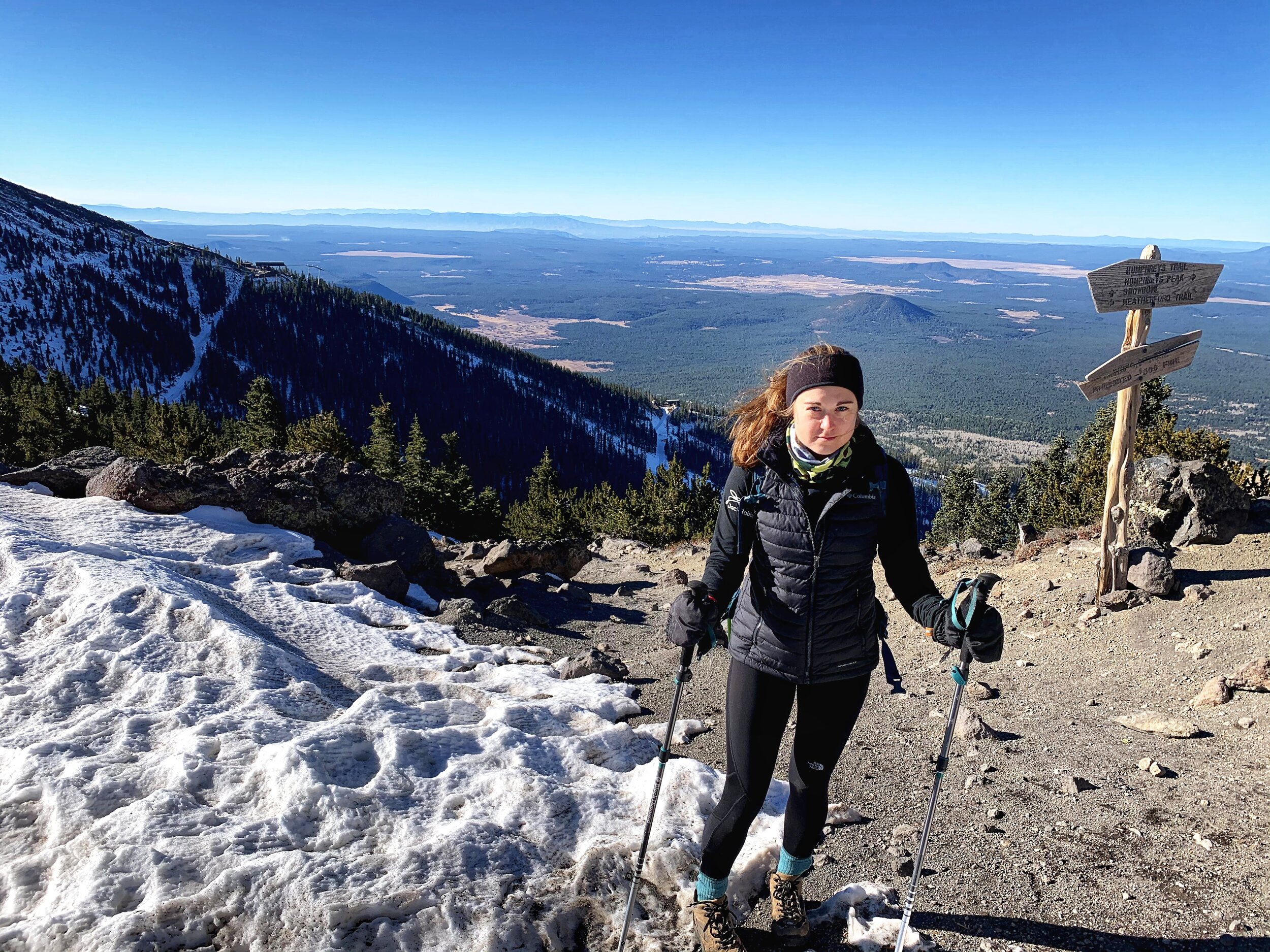
After my trip to New Hampshire this fall, an idea entered my brain that I should try to climb the tallest peak in each state (New Hampshire’s being Mount Washington). I was excited to see that Arizona’s highest point was in Flagstaff - Humphreys Peak in the San Francisco Peaks and part of the Kachina Wilderness.

Being November, we knew that the trail would have snow in places but we thought we would give it a go - and set out one morning to hike the 10.4 mile trail that climbs 3,343 feet to Humphreys Peak at 12,633 feet.

It was a short drive from our Airbnb to the trailhead and we left before sunrise with the goal of finishing in time for one last brunch at toasted owl. Pretty quickly we realized the trail was almost 100% snow packed, and fairly icy, and we were without microspikes. We relied heavily on our poles and rocks peaking out from the snow to gain our footing and it was slow going. At one point we ran into two guys coming down and asking if they had made it to the top - they told us they had turned around because it got too icy. Most people, understandably, would have turned around at that point.

Humphreys Peak AZ

But we forged ahead and eventually broke the treeline where we were greeted with WIND. a lot of wind. We then started what can only be described as a slow, terrifying struggle along the rocky ridge of a mountain. At many points we were legitimately crawling on our hands and knees fighting against the gusts. I had my poles under my arms because if I tried to use them, they just blew around in the wind.

I had read an AllTrails review that mentioned two false summits so I should have been mentally prepared but damn the summit actually seemed like it kept getting further and further away.

Humphrey's Peak Hiking

Ultimately, we called it short of the summit - it was getting too scary and miserable and turning around seemed like the smarter choice. We were both close to tears and we weren’t having an semblance of a good time.

Heading back down was equally scary, parts of my backpack were whipping me in the face, my poles were somehow making balancing harder, the trail was impossible to follow.

When we finally got back into the trees and the wind subsided a little, I finally felt like I could breathe. We started running into people who asked if we had made it to the top and we had to tell them no, but at that point I didn't even care I was so happy to be out of that situation.

Humphreys Peak Hike

The journey down was its own adventure - each step was a steep, slippery trap and I spent a lot of time on my butt. at one point Callie was laughing and crying simultaneously as we wondered how many hours this was going to take us to get back to the car.

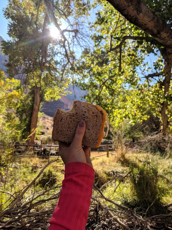
We had considered not packing sandwiches but THANK GOD we did because eating them in a patch of sun really helped our spirits. That and me singing a lot of random songs including “You’re Never Fully Dressed Without a Smile” from Annie.

Hiking Humphreys Peak

I was actually really proud of us - despite the awful conditions we didn't get too sad or mad or discouraged and by the end we found we were still happy to have spent 7 hours in the woods on our final day in Flagstaff.

My plan to hike the tallest peak in each state isn't off to a great start, and we missed brunch at Toasted Owl, but a growler and burgers from Beaver Street Brewery delivered to our Airbnb wasn't a bad way to end the day.

Flagstaff Hiking

hike fatman’s loop TRAIL

Right outside of Flagstaff we found this easy little loop that we did at sunset. There were some really awesome looking trees and rocks along the way.

It’s a quick 2.4 miles with only 561 feet of gain - perfect if you’re looking for something quick and close.

Fatman's Loop Trail Flagstaff

go shopping downtown

While waiting for our table at Dark Sky Brewing Co., we walked around downtown Flagstaff which was full of cute stores. We didn’t stop in many, but we did check out Mountain Sports Flagstaff (obsessed with these mugs!) and Babbitt’s Backcountry Outfitters.

take a day trip to the pertrified forest national park

Petrified Forest National Park

A little over 90 minutes from downtown Flagstaff is one of the lesser known National Parks - Petrified Forest and Painted Desert.

If you’re a fan of long day hikes, you may not love this National Park. But if you’re looking for a place you can drive through and see some awesome scenery, this would be a worthwhile day trip from Flagstaff!

The petrified wood is really awesome (we checked it out by walking the Long Logs and Agate House trails) and we loved getting to see the petroglyphs on Newspaper Rock. We did the Blue Mesa Trail (.9 miles) which was probably our favorite - the bluish bentonite clay looked like elephant skin!

Petrified Forest National Park

My personal favorite part of the day was getting to introduce Callie to Jimmy John’s - and eating it overlooking the Painted Desert.

To be honest, the only reason I’m glad we went is because it’s a check off the list of National Parks (I hope to one day visit all 62). I think we would have had a better time doing something in Flagstaff that day.

Painted Desert Arizona

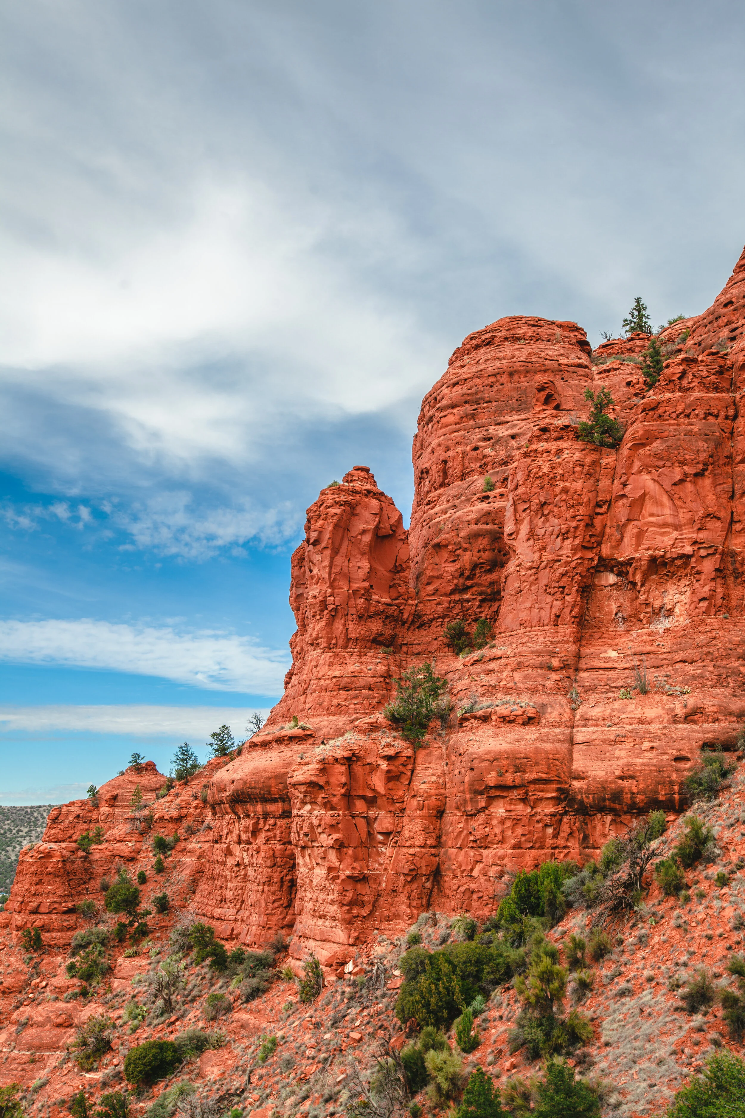
take a day trip to sedona

This could be it’s own entire blog post, because Sedona is truly one of the most beautiful places I’ve ever been! While we went as a day trip from Flagstaff, it’s definitely a place that could be a stop on your road trip for a full 1-3 days.

That being said - we fit in a good amount of Sedona sightseeing and I didn’t feel like I wasn’t ready to leave at the end of the day.

We left Flagstaff early, just as the sun was rising. We wanted to be sure we could take in the views as we drove the Oak Creek Canyon Scenic Byway (89A). The 24-mile road winds it way down 4,500 feet through a series of scenic switchbacks through Oak Creek Canyon.

Oak Creek Canyon

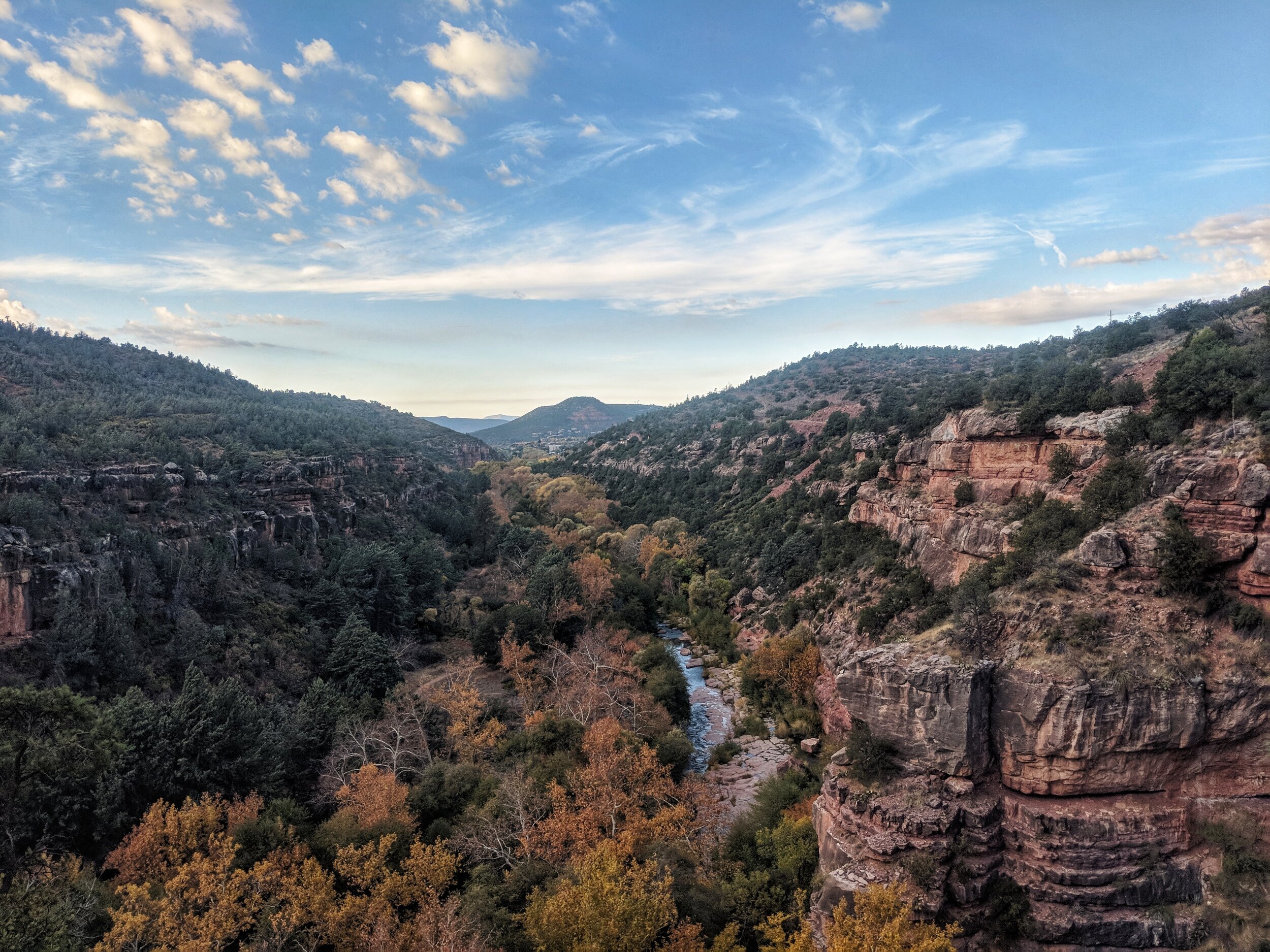
It was only about a 45 minute drive until we arrived at Midgley Bridge, where we parked for a short walk to the incredible scenic views of Oak Creek Canyon and the surrounding red rock formations.

Midgley Bridge Sedona

Next up was the Little Horse Trail - a 4.3 mile hike with 564 feet of elevation - nothing crazy, but with really great views. Once we got to Chicken Point Lookout, we continued on a little bit up the Broken Arrow Trail. The views were really beautiful and we didn’t see many other hikers. Unfortunately, the peaceful morning was made slightly less serene by the Pink Jeep Tours. But, c’est la vie.

Little Horse Trail

After our first hike we headed to Tlaquepaque Arts and Shopping Village to look for some Christmas gifts for friends and family. There were some really beautiful home goods and jewelry stores but I couldn’t settle on any of the big ticket items and walked away with just a cactus Christmas ornament.

What I really fell in love with were these mountain sculptures - which I might need to buy for myself when I move to a new apartment!

After some shopping we drove to the downtown area of Sedona and picked up sandwiches from Sedona Memories Bakery Cafe (both of the employees were not wearing masks, which we obviously didn’t appreciate as they made our food). I had read that their sandwiches were incredible and made on fresh-baked bread - but I guess I missed the memo that they were absolutely GIANT!

Sedona Memories Cafe Bakery

I also took some time to get my aura read - it seemed like a very Sedona thing to do. You’ll find a ton of places that offer aura readings, psychic readings, information on vortexes and other ~spiritual things. I was sad that I didn’t get a print out of my pictures, and I’m not sure I would do it again, but it was something different to try!

Aura Reading Sedona Arizona

We took our sandwiches and headed to hike #2 - the Brins Mesa Trail (4.5 miles, 951 feet of elevation).

Brins Mesa Trail

First of all, the sandwiches were amazing. The bread had great flavor and I am now a convert to putting cream chees on my turkey sandwiches. It was an odd assortment of ingredients (turkey, provolone cheese, cream cheese, sprouts, sunflower seeds, avocado, lettuce and cranberry sauce) but we were feeling it.

The hike had a few steep parts, we took a wrong turn, and then we wondered if there was going to be any real end point with a view but we stuck with it and the end was a really scenic spot. The wind had really picked up so we didn’t stay perched on our rock for too long, but we did spend a few minutes taking in the 360 degree red rock views and eating a little bit more of our massive sandwiches.

We returned to the car and headed to the Bell Rock trailhead lot, but followed these instructions to climb Baby Bell Rock for a stunning Sedona sunset.

Sedona Sunset

With beer in hand, we scrambled to the top of the rock where we had our own private viewing (a very drunk group climbed up for about 2 minutes but quickly disappeared) as the rocks changed colors all around us. I even Facetimed my parents to let them see it!

Sedona Sunset

After falling to get a table at Sedona’s most famous restaurant - Elote - we opted for dinner back at Tlaquepaque purely because El Rincon Mexican Restaurant appeared in the Google results for “best margaritas Sedona.”

We got a table right away at their outdoor patio and enjoyed some margs and Mexican - I only wish the meal hadn’t seemed so rushed.

And then it was time to say farewell to Sedona. We drove back along 89A and at one point, pulled over to take in the absolutely stunning sky full of stars. Leaning back on the hood of the car and looking up in the pitch black, it was nuts.

trail run to the crack swimming hole

The Crack at Wet Beaver Creek Trail Run

No trip to Arizona is complete without a visit to a hidden swimming hole (there are many to choose from). We did a trail run “The Crack” at Wet Beaver Creek on one of our driving days (between Tucson and Williams) to break up the hours in the car - but it’s about 50 minutes outside of Flagstaff.

The trail was a great run (7 miles, 500 feet of elevation gain and well-maintained) and our first taste of red rock scenery - much different than Tucson's saguaros.

When we made it to the swim hole, there were only two other people there, who had already taken the plunge! With their encouragement, Callie and I decided to jump in - from a much lower ledge.

Obviously before jumping into water, you should be sure of the depth, make sure you can see the bottom so you know nothing is below the jump area, etc.

It was FRIGID but fun and after drying a little on a sunny rock, we ran back to the car.

Trail Running Arizona

MORE TIME?

cycling

There are tons of options for gravel and road cycling in the Flagstaff area and had it been a little warmer, I probably would have chosen one of these rides over our trip to the Petrified Forest National Park.

Lake Mary Road - 62 Miles

Sinclair Wash - 5.7 Miles

Fort Valley Road - 14 Miles

Sunset Crater - Wupatki Loop - 60 Miles

Snowbowl Road - 6 Miles

more hiking

There’s tons of hiking in the Flagstaff area. One of the others I had bookmarked was:

Little Bear to Sunset Loop
7.4 Miles | 1335 Feet of Elevation

trail running

As I mentioned, the Flagstaff area is known as a place where professional runners go for altitude training. There’s tons of great runs in the area.

slide rock

A crowded but awesome Arizona favorite - I luckily got to go here on my first trip to Sedona when I was about 13! It was tons of fun - but November was a little too cold to enjoy the nature-made water slides.

YOU MAY ALSO LIKE:


AmAZing Arizona: Page & The Glen Canyon National Recreation Area

Recently, I took two weeks to go on a road trip through the state of Arizona.

Traveling, or not traveling, right now is a very personal decision and one that I did not take lightly. My friend and I agreed on some important things ahead of time - we would not be doing any indoor dining, museums, bars, etc.

Some nights, eating outside in November was more comfortable than others (plot twist: Arizona isn’t always warm). Some nights we cooked in our Airbnbs. If we encountered people without masks, even outdoors, we distanced ourselves from the situation.

I will mention things throughout these Arizona city guides in regards to how certain areas, restaurants, etc. handled coronavirus protocols.

But our overall goal for the trip was to hike, run, and generally spend time outside - alone. This was not the trip for trying all of Arizona’s restaurants and bars and museums and this guide reflects that.

You can read about our first stop, Phoenix & The Superstition Mountains here!

You can read about our second stop, Tucson & Saguaro National Park here!

You can read about our third stop, Williams & The Grand Canyon here!

Our next stop was Page, Arizona!

PAGE

Page, AZ Travel Guide

WHERE WE STAYED

Page is a small city of just over 7,000 people located on the border of Norther Arizona and Southern Utah. It’s smaller than the town I grew up in, yet it’s most popular local attractions, Lake Powell, Antelope Canyon and Horseshoe Bend, have begun to attract millions of visitors per year. That’s right - MILLIONS.

We opted for an Airbnb in town, and we absolutely loved it. I’ve never had a rental kitchen with more cooking gear! We were in heaven as we drank red wine, listened to music, and cooked ourselves a salad with roasted cauliflower, eggplant, sundried tomatoes, couscous and more.

After a stay in an Airstream, a tiny home, and a motel/trail with no electricity - we really felt like we were living large in our two bedroom, two bathroom house in Page.

WHAT to eat

We were so smitten with our kitchen, that we ate dinner both nights at our Airbnb. We didn’t make it out once while we were in Page, other than to stop at the grocery store.

Each morning of the trip we made oatmeal and coffee for breakfast and packed sandwiches to eat while we were out and about during the day - it helped save us a lot of money and most importantly limited the amount of contact with other humans!

While we were on our kayaking tour, however, a few places were recommended to us which I’ll list below (keep in mind I can’t personally vouch for any of these, but our local tour guide said they were his favorites!)

STATE 48 FOR BEER & BURGERS
614 N. NAVAJO DRIVE | PAGE, AZ

BLUE BUDDHA SUSHI LOUNGE FOR THE VOLCANO ROLL
644 N. NAVAJO DRIVE | PAGE, AZ

NEW YORK TERIYAKI FOR JAPANESE
663 S. LAKE POWELL BLVD | PAGE, AZ

what to do

The Glen Canyon National Recreation Area has so much more to offer than photography tours of Antelope Canyon and selfies at Horseshoe Bend. I’ll include details on those, because they’re not to be missed if you’re in Page, but I’m going to start this section with the less popular picks.

hike the Lee’s ferry and spencer trail lookout

Best Hikes in Page, Arizona

I’ll give you a heads up - this hike isn’t a walk in the park. But if you’re looking for a challenge or looking to work up a sweat, with the promise of some incredibly rewarding views - this trail is a must-do! We were feeling a little cocky post Grand Canyon hike, but the Spencer Trail’s 1500+ feet of elevation over a short 1.5 miles had my legs and lungs SCREAMING!

The switchbacks are bountiful and the space between you and the side of the sizable drop-off isn’t immense - I don’t know that anyone with a fear of heights would be a big fan of this hike.

When we reached the summit (after a lot of whining from me including, “WHY ARE WE DOING THIS?”) we had the entire place to ourselves and the view was stunning. A private Horseshoe Bend, totally work the sore legs. We took a good long break at the top to sit out in the sun and take in the views.

You’ll want to bring poles - it made the descent much more enjoyable. When we made it back to the parking lot, we found ourselves a patch of sand down by the Colorado River and enjoyed (another) turkey sandwich with a view.

Page Travel Guide

go adventuring in cathedral wash 

Cathedral Wash Page Arizona

I’m so glad our tour guide recommended checking out Cathedral Wash, a slot canyon blissfully free of Antelope Canyon’s crowds and though very different, stunning in it’s own right!

This 3.3 mile “hike” is more of a rock climbing/scrambling puzzle for your body and brain - but it was so different and so much fun.

There were parts where we were pretty scared and our adrenaline was definitely pumping, but looking back it was all fairly doable if you pick the right spots to go down further into the canyon.

Unfortunately, we didn’t start early enough and had to turn around before we made it to the end for fear of finding ourselves in the clot canyon after sunset. But if you make it to the end - you’ll find yourself at the Colorado River.

sunset over marble canyon on navajo bridge

Page, AZ Travel Guide

This was my favorite sunset of the entire trip, there I said it! (We had a LOT of sunset stops). My only wish is that we’d had a beer.

Again, the Navajo Bridge was recommended to us by our kayaking tour guide, who mentioned it as a place we might find some condors. While we didn’t see any massive birds (which was actually perfectly fine by me!) we did have the entire bridge to ourselves.

Looking out into the Colorado River and Marble Canyon, seeing red rocks and the horizon stretching out as far as I could see, just absolutely and entirely surrounded by nature…I get chills just thinking about how amazing it was. We really felt like something must be wrong, had everyone else in the world disappeared and we were the only ones left? Surely that’s the only reason we could be completely alone with such an epic view while hundreds of people with selfie sticks stood at Horseshoe Bend.

I can’t promise you an entirely similar experience when you visit, but I can tell you that a sunset on the Navajo Bridge is breathtakingly beautiful and absolutely worth a stop.

Oh, and there a Glen Canyon National Recreation Area gift shop!

RUN THE PAGE RIMVIEW TRAIL

Arizona Trail Running

This 9.8 mile trail, let’s just call it 10, winds it way around Page with views of Lake Powell and the Glen Canyon area. The elevation wasn’t bad at all (just 433 feet) but we had some tired legs and this was a struggggle. Even though it wasn’t a great run, it was an awesome, well marked, well-maintained trail for a sunrise run!

VISIT ANTELOPE CANYON

Antelope Canyon Travel Guide

Due to COVID-19, the typical Antelope Canyon tours, which explore the upper canyons, were all shut down. Navajo Nation is closed to tourism, and you need to entre Navajo lands in order to get to the upper canyons.

Luckily, the lower portion of Antelope Canyon was still accessible, and we were able to book a tour through Lake Powell Adventure Co. - we got to kayak to the entrance to the lower canyons and then hike a mile or so in.

We started at 10 am, and by the time we came out of the canyon, there were a LOT of kayaks and jet skis pulled up to shore. But while we explored, it was fairly uncrowded. There were a few girls clearly getting their Instagram on, and they were a little sassy with our tour guide, but nothing too annoying.

My favorite part of this excursion was getting to meet some new people - I didn’t realize how much I missed talking with strangers! Leave it to a global pandemic to make you realize maybe you don’t hate small talk as much as you thought you did.

Our tour guide was full of interesting information and stories and we happily chatted and paddled the whole trip. He also knew all the best spots for pictures.

The canyon itself was really beautiful - the rock is so smooth, I couldn’t stop touching it! At one point, it was a straight up zig zag of rock formations that we had to navigate through. Very cool.

While I enjoyed the tour experience, and I’m really glad we did it, it’s also possible to kayak, jet ski or rent a boat and go to the lower canyon on your own.

HORSESHOE BEND

Horseshoe Bend Sunset

We opted to head to Horseshoe Bend at sunset - and were confused by the crowds leaving 10 minutes before sunset.

Anyway - entry fee is $10 - which I’m happy to support the local area - but it’s also slightly annoying that they don’t accept National Parks passes or Glen Canyon parking passes.

If you’re someone who isn’t into the touristy spots, and likes hiking- you can really skip this stop, in my opinion. It’s a boring 1 mile walk to a lookout with tons of people taking pictures. The fact that they give you a brochure about the “hike” and packing water is…ugh.

BUT I’m not here to judge - if you want a $10 Instagram picture for minimal physical effort (hey, it’s vacation, after all) then by all means make sure this is on your itinerary.

We scoped out a rock and sat and drank a prickly pear sour beer which made the experience much more enjoyable! And the sunset WAS really beautiful.

MORE TIME?

There’s SO much to do from Page. I definitely think people underestimate the area. Here are a few more ideas in case you decide to stay long (a decision I support!)

BUCKSKIN GULCH

The only reason we ultimately decided against this hike is that it requires driving down a fairly long dirt road - and with our rental, we didn’t want to risk it. It probably would have been fine, but 4-wheel drive would be ideal.

The trailhead of Wire Pass is in Kanab, Utah and meets up with the Buckskin Gulch Slot Canyon within Paria Canyon - Vermilion Cliffs Wilderness.

VISIT “THE WAVE” - IF YOU’RE LUCKY & PLAN FAR IN ADVANCE!

The Wire Pass trailhead is actually the way you would navigate to the insta-famous “The Wave” rock formation that’s part of the Coyotte Buttes (North). But in order to do so, you’ll need a permit (awarded via lottery) as only 20 people are permitted to hike the Coyote Buttes (North and South) each day.

Ultimately, I’m really glad we found out about Cathedral Wash!

COYOTE GULCH HIKE

An arch rock and a waterfall are the draws to this 10.6 mile hike!

SPEND A DAY ON LAKE POWELL

Whether you choose to rent a houseboat, a motorboat, a jet ski, a kayak or a standup paddle board - if I were here in the summer I would 100% spend more time on the water! There are SO many local tour companies. It’s a big party, from what I hear!

DAY TRIP TO UTAH

The Glen Canyon area has plenty to offer - but if you’re in Page for a longer amount of time and feel like crossing the border into Utah - there are a ton of options there as well. Within driving distance are some of Utah’s Greatest Hits including Bryce Canyon National Park (2.5 hours), Zion National Park (1 hour 45 minutes) and parts of Grand-Staircase Escalante National Monument (varying distances).

YOU MAY ALSO LIKE:


AmAZing Arizona: Williams & The Grand Canyon

Recently, I took two weeks to go on a road trip through the state of Arizona.

Traveling, or not traveling, right now is a very personal decision and one that I did not take lightly. My friend and I agreed on some important things ahead of time - we would not be doing any indoor dining, museums, bars, etc.

Some nights, eating outside in November was more comfortable than others (plot twist: Arizona isn’t always warm). Some nights we cooked in our Airbnbs. If we encountered people without masks, even outdoors, we distanced ourselves from the situation.

I will mention things throughout these Arizona city guides in regards to how certain areas, restaurants, etc. handled coronavirus protocols.

But our overall goal for the trip was to hike, run, and generally spend time outside - alone. This was not the trip for trying all of Arizona’s restaurants and bars and museums and this guide reflects that.

You can read about our first stop, Phoenix & The Superstition Mountains here!

You can read about our second stop, Tucson and Saguaro National Park here!

Stop #3 was Williams - “Gateway to the Grand Canyon.”

How to Hike Grand Canyon During COVID 19

WILLIAMS

WHERE WE STAYED

To say we stayed in Williams would be a little misleading. Yes, the address of our Airbnb was Williams, AZ - but our trailer/motel was really in the middle of nowhere - a 40 minute drive to downtown Williams’ restaurants and stores and a 30 minute drive to the south gate of the Grand Canyon.

Seeing as the hotels and lodges within the Grand Canyon need to be booked about a year in advance, we were lucky to be within 30 minutes of the entrance. But we felt very much in the middle of nowhere - and our second night we returned to find no power and no flushing toilet.

While I wouldn’t return to this particular Airbnb, it did make it possible to arrive at the Backcountry Visitor Center by 5:15 AM. Had we been coming from Flagstaff (the closest major city to the South Rim), the 90 minute drive may have deterred us from our full-day hiking plans.

WHAT TO EAT

HISTORIC BREWING BARREL + BOTTLE HOUSE
141 W RAILROAD AVE | WILLIAMS, AZ

Historic Brewing Barrel Williams Arizona

The friendly staff at this brewery (with another location in Flagstaff) accommodated our (somewhat crazy) request to eat outdoors on a 30 degree night - dragging heat lamps over and serving up cold beers and warm mac & cheese, burgers and fries. After a 15 hour day and 19 mile hike - it might have been the happiest meal ever.

PINE COUNTRY RESTAURANT
107 N GRAND CANYON BOULEVARD | WILLIAMS, AZ

This was nothing to write home about, especially seeing as we took it to go and ate it in a motel room with plastic cutlery - but it was something easy to pick up as we passed through Williams on the way to our Airbnb.

ROCK SPRINGS CAFE
35900 OLD BLACK CANYON HIGHWAY | BLACK CANYON CITY, AZ

Rock Springs Cafe Pie Arizona

Speaking of passing through - if you find yourself driving between Flagstaff and Phoenix - you’ll want to plan on a pit stop at Rock Springs Cafe for some roadside pie! Yep, you read that right. This popular highway stop is equipped with gift shops, a restaurant, a gas station and really really popular pie. We popped in quickly (masks didn’t seem to be popular in Black Canyon City) and bought a slice of rhubarb and a slice of banana cream, both of which were delicious.

WHAT TO DO

SUNRISE TO SUNSET AT (AND IN) THE GRAND CANYON

Grand Canyon Sunset

I am so glad that Callie was so enthusiastic about the rim to rim Grand Canyon hike - it was 100% without a doubt one of the coolest experiences I’ve ever had. If you only have one day to experience the Grand Canyon - this is how you should experience it.

It took some time to figure out the logistics, but I’ll try to simplify it here for you.

THE TRAIL

Grand Canyon Rim to Rim

While hiking a true rim to rim path (or running it) is definitely an adventure - the drive between the North & South rims is approximately 5 hours. To avoid that logistical nightmare, many people opt to hike down to the bottom of the Grand Canyon via the South Kaibab trail and back up along the slightly longer and less steep Bright Angel Trail.

According to AllTrails, this route is 17.5 miles and 4,845 feet of elevation. My Garmin recording came in at 18.25 miles and 6,130 feet of elevation. Our moving time was 6 hours and 55 minutes and start to finish, with lunch and bathroom and photo breaks, we were in the canyon for 8 hours and 45 minutes.

THE LOGISTICS

Grand Cayon Ooh Aah Point

We arrived at 5:15 AM at the Backcountry Information Center (1 Backcountry Rd, Grand Canyon Village, AZ 86023). Don’t dilly dally in the car like we did - get out into the cold and stand in line for the 6 AM Hikers’ Express Shuttle (there are also shuttles at 7 AM, 8 AM and 9 AM). We nearly didn’t get a seat on the bus, which is operating at limited capacity (just 15 passengers each hour) due to COVID-19.

And yes - Arizona gets COLD. When we started our hike in November, it was about 20 degrees outside.

The shuttle (masks mandatory) will bring you to the South Kaibab Trailhead. When you finish the hike at the Bright Angel Trailhead, you’ll be about a 10 minute walk from your car at the Backcountry Information Center.

In November, some restrooms were open at points along the way (Cedar Ridge, Indian Garden) but most water was shut off for the season. You could filter from the creek, but with lower temperatures, carrying 4 liters each was plenty.

THE JOURNEY

Grand Canyon Rim to Rim How To

We started off cold, with headlamps on, and nerves high. The beginning of the South Kaibab trail was icy and we were very focused on our feet and not slipping. I had to stop for a minute and look to my left - reminding myself that I was about to walk down to the bottom of the Grand Canyon. I could faintly make out the outlines of the canyon and said to Callie, “Callie - it’s the GRAND CANYON!”

As the sun started to illuminate the sky, we made it to the aptly named Ooh Aah Point, a little less than a mile into the canyon. Obviously, we stopped for some pictures (and for some oohing and aahing).

Ooh Aah Point Grand Canyon

Before we knew it, we were taking off a layer or two and putting our headlamps away.

The trip down was made a LOT easier with trekking poles, I shudder to think what my knees would have felt like without them! There were some very cool parts where it seemed we were walking out into the middle of nothing before the path would take another curve. Cedar Ridge was one of my favorite bits of the South Kaibab Trail.

Grand Canyon Rim to Rim How To Guide

Excitement levels escalated as we got our first glimpse of the Colorado River’s blue water below. But it still looked so far away!

Eventually, we made it to the first of two suspension bridges we would cross - the Black Bridge (built in 1928). Unlike to the Capilano or Lynn Canyon Suspension Bridges in Vancouver - filled with wannabe Instagram influencers - we had the entire Black Bridge to OURSELVES. We got to cross the Colorado in complete solitude (and didn’t feel rushed when we obviously had our own photoshoot).

Grand Canyon Suspension Bridge

After we crossed the bridge it wasn’t long until we were at the canyon’s floor, right up close and personal with the Colorado River. Unfortunately, Phantom Ranch was closed for the season, but we still took a walk around to check it out.

Overall, the hike down was great! The sunrise, adrenaline, the sense of awe - time passed pretty quickly. South Kaibab is a trail used by the Grand Canyon mules (as is Bright Angel) so don’t be surprised if you have to wait for a pack to pass you by or if parts of the trail are, well, poopy.

Colorado River Grand Canyon

By the time we reached Phantom Ranch (about 7 miles in) I was actually VERY excited to start walking UP instead of down. I hoped I wouldn’t soon regret that wish!

Pretty quickly we crossed back over the Colorado River (this time on the Silver Bridge - another suspension bridge), and started our hike to the next main rest area - Indian Garden where we figured we would stop for lunch.

The first 6 or so miles up the Bright Angel trail were so scenic and so not what I expected to find in the Grand Canyon - lush, green areas made me feel like I was in the middle of the Amazon rainforest! Bright Angel was definitely more crowded (and would become even more so the further up we got) but there were only a few times where we felt uncomfortably sandwiched between other groups of hikers.

Grand Canyon Rim to Rim How To

It honestly didn’t feel too challenging between Phantom Ranch and Indian Garden - we were definitely going up, but it was gradual and beautiful and we had turkey sandwiches to look forward to. When we reached Indian Garden we found a picnic table in the creek and had the most scenic lunch I’ll probably ever experience. I never wanted to leave!

Indian Garden Grand Canyon

From Indian Garden we knew we only had about 4 miles left in our journey - we marveled at the fact that we felt great, but knew that people said the last 3-4 miles were the real slog.

For us, we never felt that any part of this was a slog. Just an absolutely perfect day. Ew, I sound so annoying don’t I? But seriously, I couldn’t get over how lucky I was to spend 8 hours exploring such an iconic natural wonder.

Towards the top of Bright Angel, things got slippery and icy again, but before we knew it, we had reached the end. I couldn’t help but be sad it was over. On our walk back to the car we joked, “we could totally go and do that again right now, I’m not tired at all!”

Grand Canyon Rim to Rim How To

Once we sat down in the car, took our hiking boots off, and broke into the trail mix, however, the adrenaline subsided and the sleepiness hit HARD. We drove over to Mather Point and split a beer while waiting for sunset time - scrolling through our pictures and reminiscing about our favorite parts of the day.

We dragged ourselves out of the car eventually and walked over to the gift store where we couldn’t help but buy ourselves matching long sleeve t-shirts to mark the day (my longest hike ever!).

Mather Point was crowded for sunset, but not even the crowds took away from the beauty that is Grand Canyon at sunset.

Grand Canyon Sunset

WHAT WOULD I DO DIFFERENTLY?

In a perfect world, we would have stayed right within the Grand Canyon and we wouldn’t have showered by headlamp in a cold trailer after a 15 hour day…but other than that, I honestly wouldn’t change much. We’re already talking about wanting to run rim to rim to rim in a day - just a casual 40+ mile run.

For anyone who has ever considered a hike like this and has been deterred by the distance and the elevation - don’t underestimate yourself and the inspiration that the Grand Canyon can give you. And go in November…I promise you it’s a lot nicer hiking 18 miles in 40 degrees as opposed to 112.

HAVE YOU BEEN TO THE GRAND CANYON? WOULD YOU TRY THIS HIKE?

YOU MAKE ALSO LIKE:


AmAZing Arizona: Tucson & Saguaro National Park

Few states have as varied a terrain and climate as Arizona. It's an outdoor adventurers ultimate destination - hiking, trail running, mountain biking and kayaking opportunities abound. Follow along for all the must see destinations, must visit National Parks and must drink craft beers across the state. From Tucson to Page, this Personalized Passport travel guide will cover it all.

AmAZing Arizona: Phoenix & The Superstition Mountains

Few states have as varied a terrain and climate as Arizona. It's an outdoor adventurers ultimate destination - hiking, trail running, mountain biking and kayaking opportunities abound. Follow along for all the must see destinations, must visit National Parks and must drink craft beers across the state. From Tucson to Page, this guide in multiple parts will cover it all.

The Ultimate South Africa Itinerary

The Ultimate South Africa Itinerary

Though I had to cancel my April 2020 trip to South Africa, I thought I’d share my itinerary regardless. I spent a lot of hours poring through research and information to put it together - hours that I thoroughly enjoyed. Maybe it will inspire you to add South Africa to your travel bucket list. Or maybe you’ll want my help!

8 Ways to Cure Wanderlust During the COVID-19 Pandemic

March 15, 2020: “The Day the World Stopped Traveling.” This gloomy headline was the title of a recent letter to readers published by leading travel news website Skift.

Unfortunately, it’s not an exaggeration given the current global pandemic we are all being faced with.

So how can those of us with wanderlust continue to live out our travel dreams? Here are some ideas for curing your wanderlust.